geoint
GEOINT in National Security Applications
January 21 by Alexander Stephenson
Defence iQ in partnership with Maxar surveyed over 200 geospatial intelligence practitioners. The finished result is a 16 page document filled with market intelligence and key findings covering the us...
APAC National Security: Why GIS Is More Important Than Ever Before
July 23 by Defence IQ Digital
Transformative new developments in GIS technology have prompted national security organisations across APAC to enhance their GEOINT capabilities. Defence IQ takes a look at the views of leading...
GEOINT: Latest Technologies and Opportunities to Enhance APAC Security
July 23 by Defence IQ Digital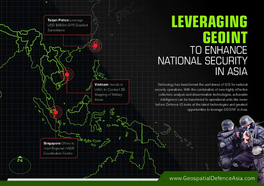
Technology has transformed the usefulness of GIS for national security operations. With the combination of new highly effective collection, analysis and dissemination technologies, actionable in...
Maritime e-Navigation prevents ships from "disappearing"
May 28 by Richard de SilvaIntegration, interoperability and harmonization are all common buzzwords in the fields of security, but to many, they have real meaning. The International Maritime Organisation, for example, is now...
BAE Systems to Provide Advanced Data Management Capabilities to the National Geospatial-Intelligence Agency
May 21 by BAE SystemsSAN DIEGO --The National Geospatial-Intelligence Agency (NGA) awarded BAE Systems the iSToRE XP contract to provide advanced data management capabilities in support of National System for Geospatial...
The secret to providing quality GEOINT to Warfighter
June 07 by Bryan CamoensColonel Steven Beckman, Assistant Director of Intelligence at the Directorate of Intelligence, Joint Chiefs of Staff, J-2 US Department of Defense, discusses the best quality GEOINT possible to the...